Development Seed Labs
Skynet - Machine Learning for Satellite Imagery
Quickly analyze massive amounts of satellite imagery using machine learning and open data
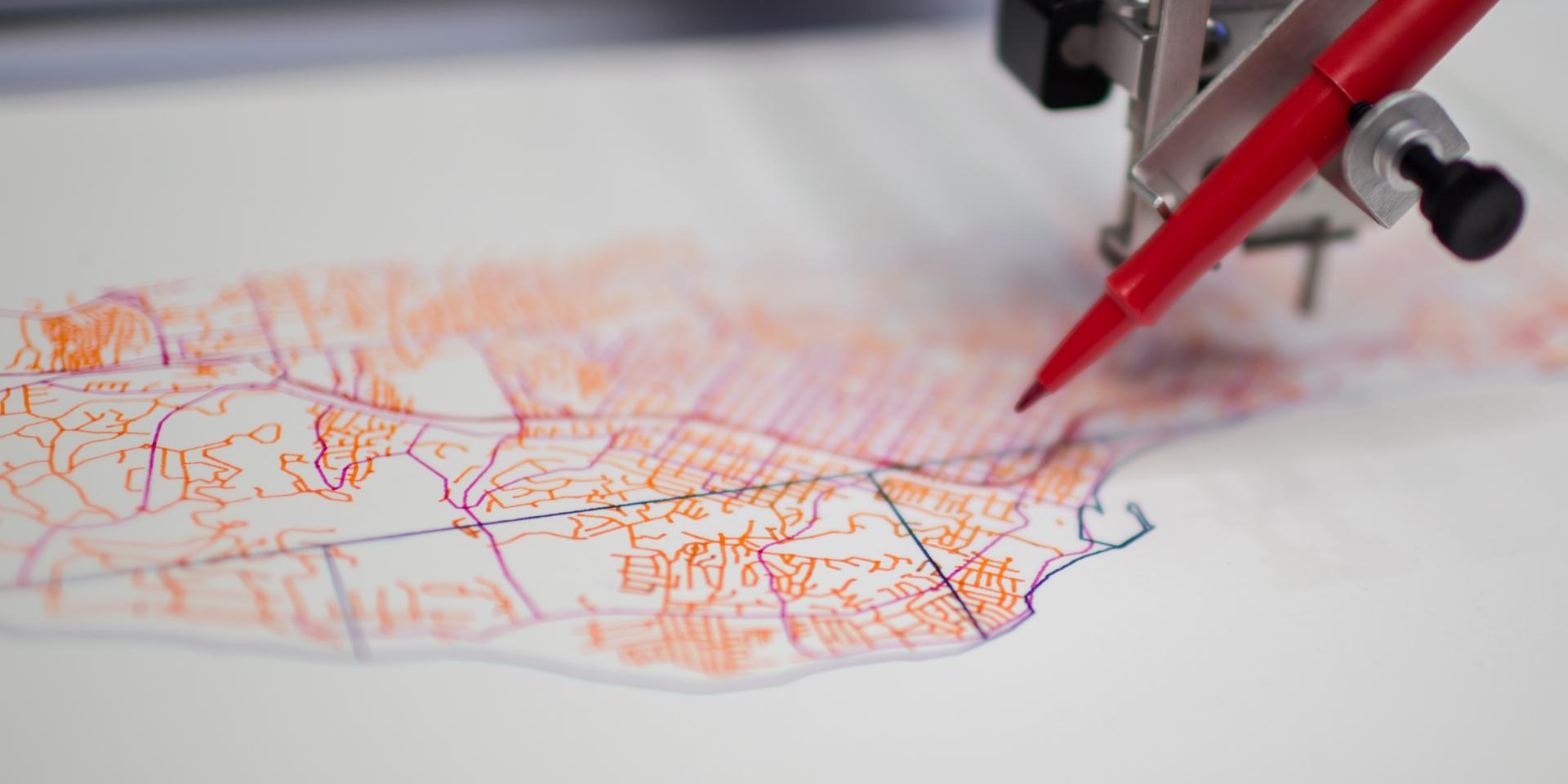
Skynet is our machine learning platform. It quickly scans vast archives of satellite and drone imagery and delivers usable insights to decisionmakers. Our partners use Skynet to reliably extract roads and buildings from images that NASA, ESA, and private satellites and drones record daily. The tool is remarkably versatile. We are experimenting with using Skynet to detect electricity infrastructure, locate schools, and evaluate crop performance.
Hundreds of satellites constantly photograph the earth, providing tremendous insight into our changing planet and populations. We built Skynet to unlock the data in these images. Skynet detects patterns that allow it to identify and evaluate features in a given image. At the core of Skynet is SegNet, a best-of-breed machine learning framework for analyzing the contents of photographs. We’ve extended this framework for use with satellite and drone imagery.
Skynet includes a suite of tools that make outputs and predictions useful for decisionmakers.
Built for the whole globe
Skynet models perform better in developing countries, because they are trained there.
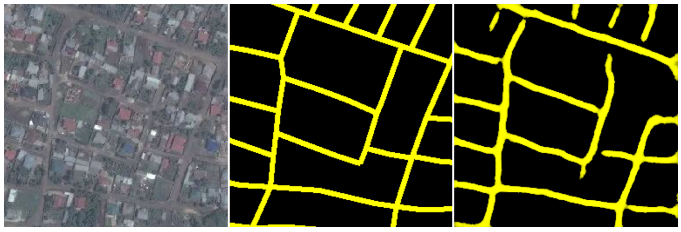
Most machine learning algorithms are based on data from the US and Europe, where you can easily find rich training data and deep archives of high-resolution imagery. These models often perform very poorly in other countries, where roads and buildings have different design and composition.
Skynet models are trained on data from the environment in which they will be used. We work with your team to find appropriate training data for the questions you want to answer. We equip your network with field data collection tools to collect the right training data, and we partner with crowdsourcing projects like the OpenStreetMap community. Field data collection doesn’t have to be extensive; we can usually train a model on a small amount of highly accurate data.
Open By Default
Skynet is designed to support open algorithm development. The Skynet code is entirely open source and is available on github. Our workflow links directly to OpenStreetMap, and we encourage using OpenStreetMap as part of any field effort to collect training data. When we create a model using Skynet, we provide that model under an open source license. This allows you to scale your work and to share the model with in-country partners, without licensing fees or restrictions.
Open algorithms lead to reproducible research and the comparable results needed to track changes over time. They also allow public funds to be spent elsewhere. Open algorithms are critical to the development of machine learning for government and humanitarian sectors.
Data directly to your decisionmaking pipeline
Skynet integrates into your existing decisionmaking tools. It generates data in usable formats available through an API. As soon as Skynet identifies a change or new feature, it can generate an alert or serve data directly to your app.
Skynet Scrub is a tool to clean the outputs of Skynet. This is part of our larger effort to build end-to-end machine learning pipelines that deliver usable insights to humanitarian and global development organizations. Skynet gets more capable every day, but the output is still not perfect. This is especially true in the less-developed regions where Skynet is most useful, which lack rich training data. With Scrub you can clean the results before they hit your decision tools.
Give us a shout to discuss how you can use powerful machine learning and satellite imagery in your next project.