Development Seed Labs
Opening Up 140,000 Miles of Road Data in Africa
Processing 140,000 miles of road data

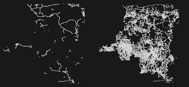
Working with FAO’s Africover project and the UN’s Data Exchange Platform for the Horn of Africa (DEPHA), we opened up over 140,000 miles of road data in seven African nations on OpenStreetMap.
The new data is from the Congo DRC, Tanzania, Sudan, Kenya, Burundi, and Rwanda. This is a huge open data win and a good win for our operations since OpenStreetMap data plays a crucial role in many of our mapping projects. Adding this information to a widely accessible public source represents a significant improvement to available coverage, especially in rural areas.
The work was carried out by our GIS for Humanitarian Relief team. The team was given basic training in OpenStreetMap tools, and then, using the JOSM editor, removed duplicate data and made sure new data was tagged correctly. Finally each layer was checked by a second team member before being added to the data set.