With World Bank
Building a better road network
Deep data for road investments
Openroads is a suite of road mapping and planning tools that empowers road managers to make better investment decisions. Development Seed is partnering with the World Bank to deploy Openroads in Vietnam and the Philippines.
Openroads leverages tools from Taurus to build a better roadmap for road planners. At it’s core is Macrocosm, a powerful collaborative editing tool. Based off of the software that powers OpenStreetMap (OSM), Macrocosm integrates with mobile surveying apps to support data collection efforts. Automated error checking and conflation detection ensure the data is trust-worthy and dependable.
To capture roads outside of survey areas, Skynet our machine learning suite, gives managers the power to extract road geography and condition from recent DigitalGlobe and Planet Labs imagery. This data stream directly into decisionmaking pipelines, so governments can build better road networks.
Better Progress Tracking
In Vietnam, we incorporated the Whole of Network - the overall view of the road network including roads that are investment targets. This approach allows organizations to track progress of the mapping process itself down to the lowest administrative level, by importing all the road network geometries available at the start of the project. Whole of Network ensures that analysis is done with the complete picture of the network and not in isolation.
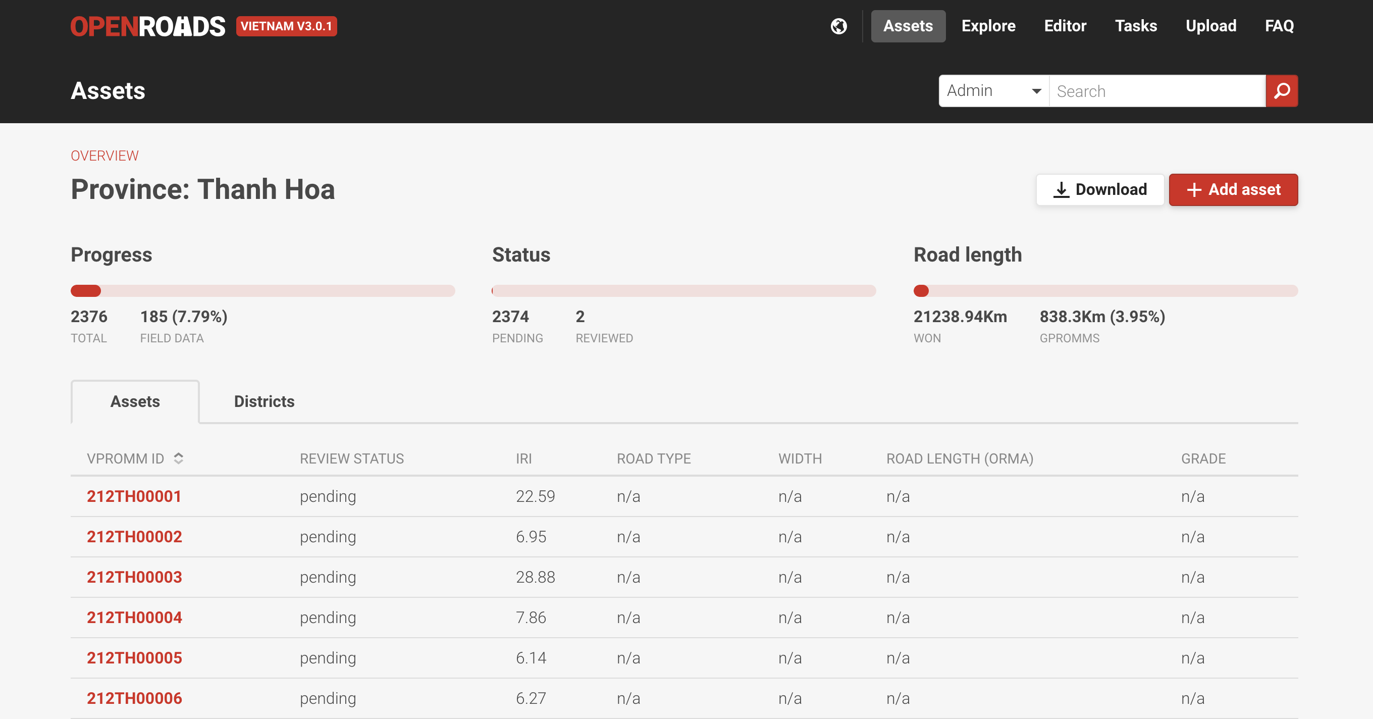
Field data collection is then conflated automatically to the road network and attributes are added. This helps to check what the coverage of data collection is at any point in time, and structure incentives to local governing bodies.
Sourcing from Satellites, Cell Phones, and Telemetry
A collaborative editing model allows government agencies at multiple levels to collaborate in improving the map. Those officials closest to a road can maintain data around it; everyone else across government can work with the same understanding of the state of the road network.
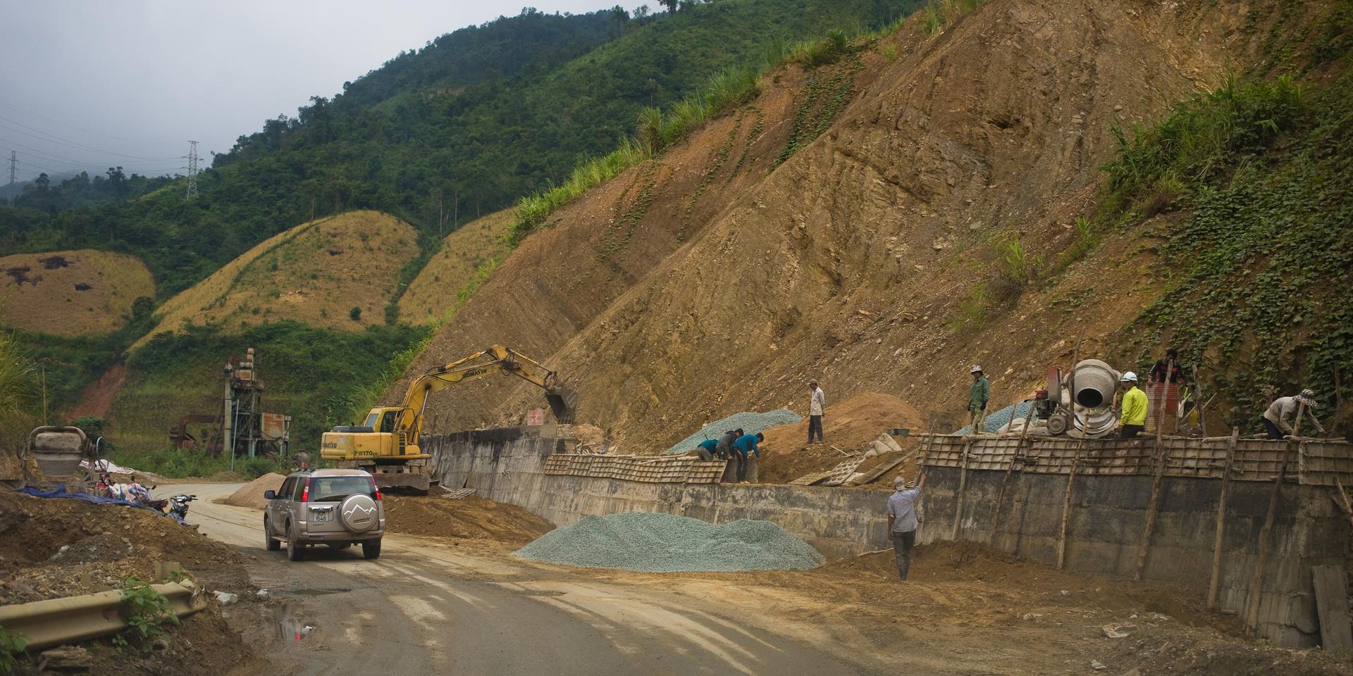
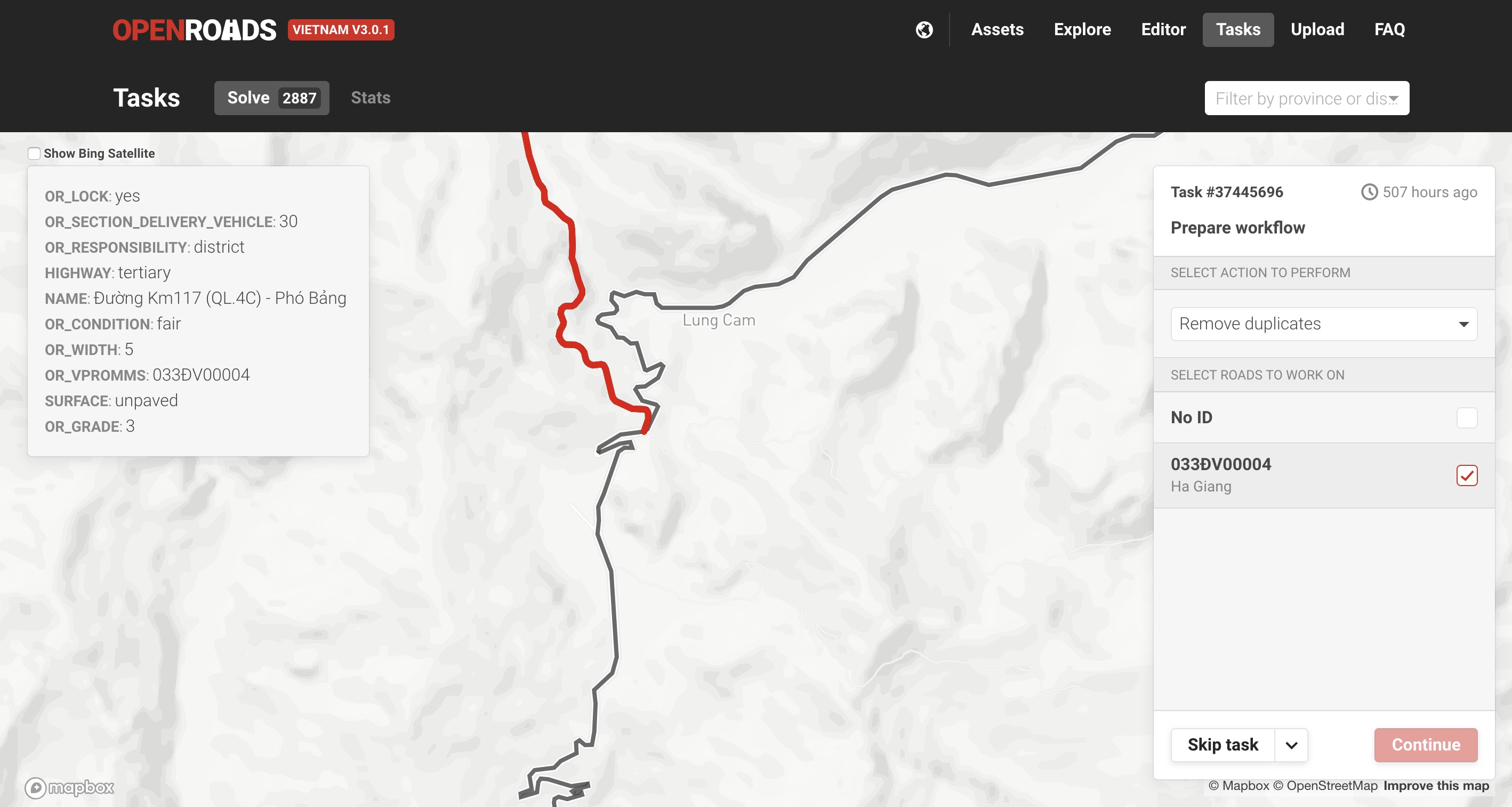
Editing geography by hand, however, is a time-consuming process. So we built automated interfaces that amplify data collection. Openroads Vietnam can automatically process and ingest road geographies and conditions collected by RoadLab-Pro - a mobile survey app that collects information about road quality along with other metadata. This data goes through an error detection process, which sniffs out impossible turns, duplicate parallel roads, and unjoined intersections. These feed a tasking dashboard that suggests the most likely fixes.
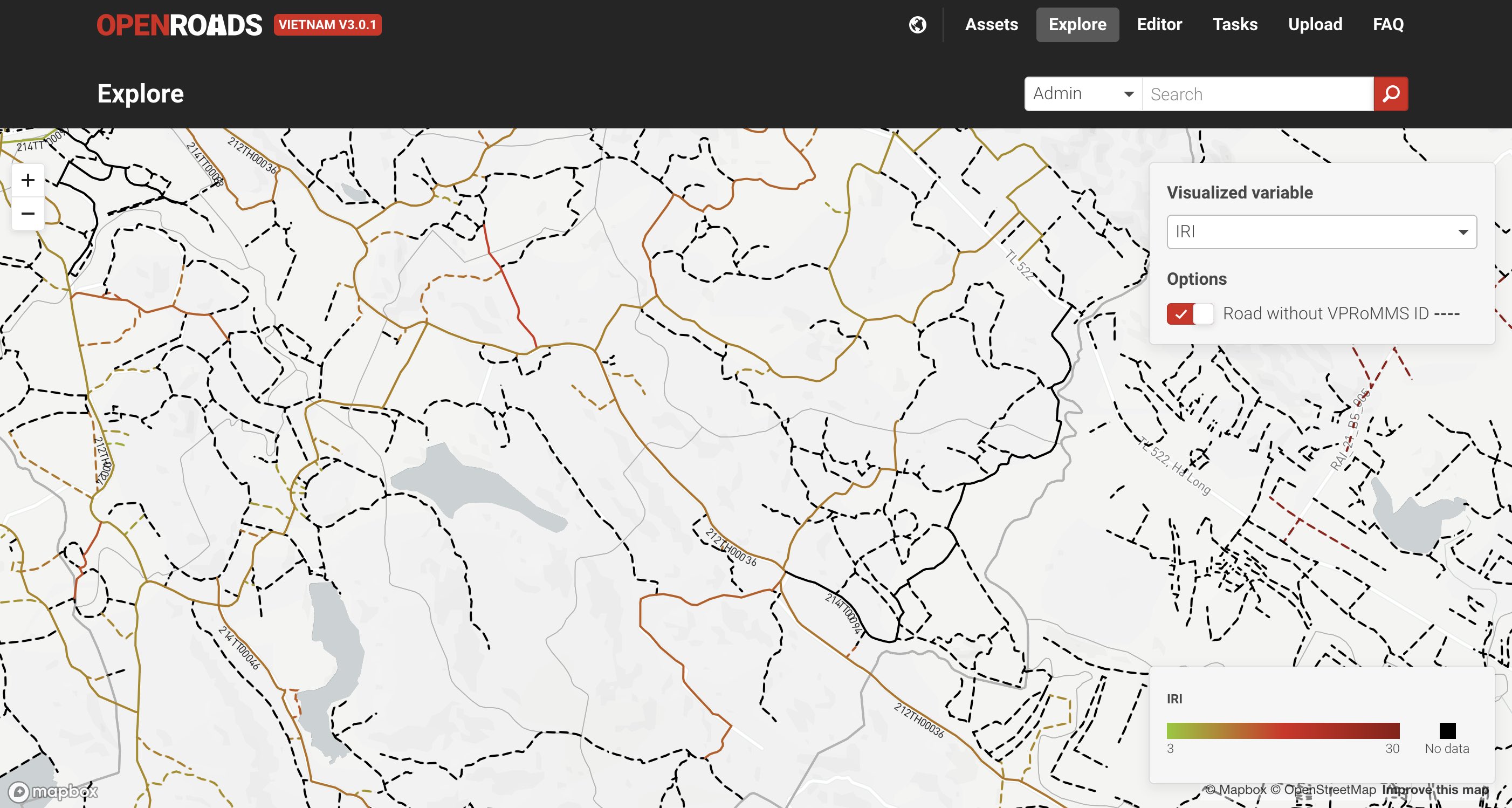
One of the core attributes tracked by Openroads is the International Roughness Index (IRI) which is a standard methodology to track the surface quality of a road through field surveys. Openroads Vietnam also has a pipeline to process large-scale telemetry data from commercial vehicles to derive historical traffic volume. Traffic volume is a key attribute to prioritize road investments.
Using these tools, a small team can keep their data up-to-date, even as conditions change and weather impacts alter the network daily.
Creating new insight, making new impact
There are an estimated 300,000 km of roads in the Philippines. Before we deployed Openroads, the national government had mapped around 10% of these. On this information alone, the government funded millions of dollars of road improvement project every year.
This problem isn’t unique to the Philippines. Around the world, governments determine billions of dollars of road investments without an actual road map. A map of roads would clearly lead to better investment decisions, but this is easier said than done. Local road managers, who have the best information on road networks and conditions lack the tools (and sometimes the incentive) to provide accurate, timely information about roads and road conditions.
The World Bank is working with national authorities to institute a policy of “No map, no money.” A full roadmap will be required a pre-requisite to receiving road improvement funds. We’ve been building Openroads to make this possible. By combining existing data, and building an intuitive UI to create new data, we will continue to work towards a full roadmap of the Philippines road network, in a manner that doesn’t require expensive software licenses or specialized training.
Making policies meaningful
A dashboard isn’t a sign that a data project has been successful. A successful data project allows a national policy instrument like “No Money, No Roads” to be a reality.
At a global level Openroads directly supports the SDGs, specifically SDGs related to providing access to services and transport. Data from Openroads can directly connect to the Rural Accessibility Map, a tool to model the impact of various improvements on access to hospitals, wells, and other crucial infrastructure.